I love maps, particularly if they are of the D&D variety. I can’t tell you how many hours I spent as a kid drawing dungeons on graph paper.
I think about D&D maps even when I’m on vacation. I was in Mexico last Winter and I grabbed a stack of tourist maps from the travel agency office. The guy who ran the booth thought he was getting a customer, but little did he know that I was just pilfering them for map inspiration.
Map inspiration is actually our theme for the next few hundred words. The best source of inspiration you have for great D&D or Pathfinder maps is the real world. Simply think of the places you have visited and search for them in your map program (I’m an Apple guy, but Google maps functions just the same for this).
Some tips:
- Make sure you select the ‘Satellite’ option. Getting a flavor for the vegetation around is really helpful. Remember, there be monsters in those forests!
- But don’t forget to click to plain street view. That comes in handy when you are drawing village streets.
- Use the 3D feature to tilt the perspective. Inspiration can come when you look at something from a different angle.
- Turn off labels. They just clutter up your view.
Now I’ll take you to some of the locales where I’ve used aerial satellite maps to inspire my D&D maps.
Using Aerial Satellite Images as Inspiration for D&D Maps
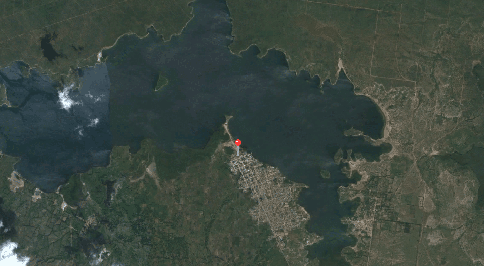
Satellite imagery can really help with shorelines. The above satellite image is of Fort Liberte, Haiti. I have a set of travel images stored as favorites because I sometimes like to reminisce about places I’ve been.
When I last looked at this one I immediately grabbed my graph paper as the shoreline was just to good to pass up. This reminds me of the Inner Sea region of Pathfinder, so I began to imagine all the tiny locales that would be littered around the shoreline.
Remember, satellite imagery can really zoom in tight. The above photo is still Fort Liberte, Haiti, only it is now zoomed way in and ready to serve as inspiration for a D&D city map. Haiti’s narrow streets and cramped building style really serves to inspire the D&D city map aesthetic.
Just look at that! All you’d need to do is mark the tavern, temple, and wizard’s supply store.
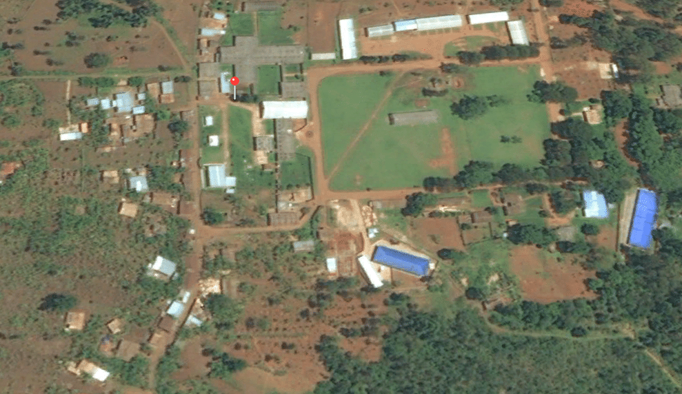
What could happen if you simply changed one thing about the map? The above satellite photo is of Kibuye, Burundi. It’s a tiny missionary outpost that is in one of the most beautiful valleys you could ever see. But look at that soccer field in the northeast corner.
What if you’d turn that soccer field into a small lake? Suddenly you have yourself a pretty ready to go village, built for it’s strategic location near a water source (don’t forget a small inlet and outlet). Or take it another direction: What if the soccer field was a gladiator pit? Suddenly you have an adventure hook.
Think if there is one thing you can reimagine in a satellite map that will give your D&D adventure some interest and plausibility.
Don’t be afraid to let the local folklore or habitat inspire you. The above satellite image is Siamajele, Zambia. In terms of ease at which you could quickly sketch a town or village, it’s probably not the most inspiring. But when I traveled there, I asked the locals why so many houses were built up on the hill, away from the only source of fresh water. Their one word answer was “hippos.”
While a hippopotamus may seem like a gentle creature, don’t let them fool you. They may only have four teeth, but they are big teeth. Worse, hippos are very territorial and are known to be aggressive toward people on the shores edge. I wouldn’t build my house nor plant my farm near them either, even if it meant I’d have to walk for water.
But darned if that doesn’t make for great inspiration for a D&D adventure. Quickly sketch a town, except something clearly isn’t right.
- Maybe all the houses near the docks have been burned down.
- Maybe there are skulls along one side of the city walls.
- Maybe a section of town is quarantined for some reason.
Now invent a story for the creature that made it that way and create a narrative for how the townspeople have adjusted. Your heroes now have an adventure!
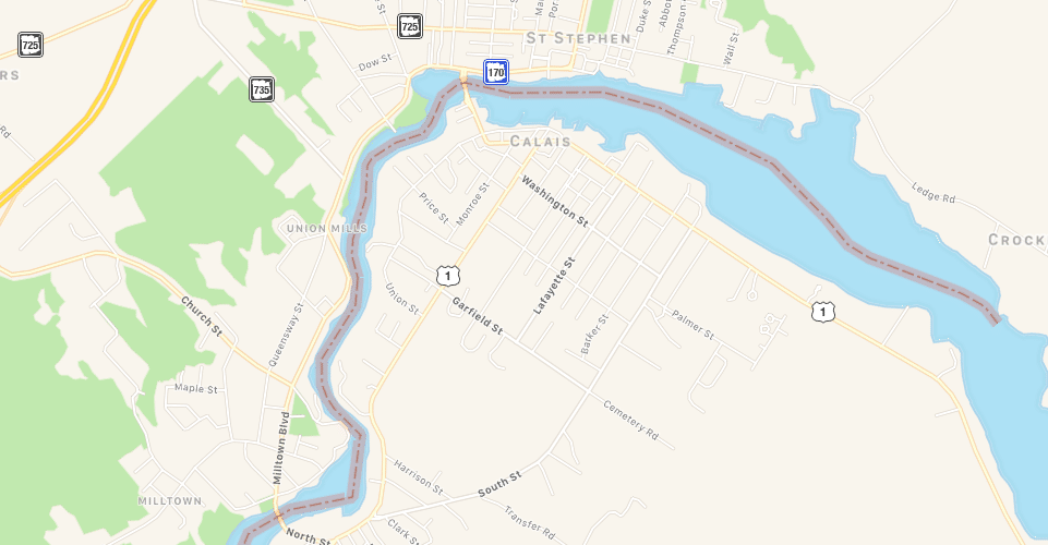
Don’t think more developed nations don’t have something to offer as map inspiration. The above satellite map is of St. Stephen, New Brunswick. My wife and I had our first date in Canada, so I dropped a pin in it to remember.
I turned off the satellite view as the local vegetation wasn’t offering as much in the way of inspiration. But I was struck at how easily that could be a D&D settlement that was built along a river. Be right back, I need to grab my graph paper!
Don’t limit it to places you’ve been. The above satellite photo is of Angkor Wat. I’ve never been to Angkor Wat, although I’ve always dreamed of going. Why shouldn’t I use a place with so much history in a D&D adventure? That’s a rhetorical question, because I of course should use Angkor Was in a D&D adventure, and you should feel free to let real life places inspire your D&D maps as well.
That’s just a brief introduction to how you can use aerial imagery to inspire your D&D or Pathfinder map making. Now add your own creativity to the mix.
If you’ve enjoyed anything you’ve read on Nerds on Earth, please do us a solid and help us boost the signal by sharing it via the social media buttons around the site. Liking us on Facebook is appreciated as well.
Thanks for reading.